Island Walks, Collaborative Mapping: Social Design Education on Matsu’s Western Peninsula
The typhoon disrupted the original flight schedule, forcing the trip to be postponed twice. It was not until the weather finally settled that the faculty and students were able to arrive in Nangan. The airport was still filled with damp sea air as the students stepped off the plane, dragging their luggage and carrying their drawings. Before they had even had time to adjust to the rhythm of island life, they were reminded, “We’ll be walking into the village later.”
Little by little, they began to sense that their understanding of the scale of everyday life was changing. Precisely because the journey was challenging, it became all the more worthwhile to explore. This was not simply a field trip, but the beginning of a journey that required them to slow down and relearn how to observe.
Learning Objectives
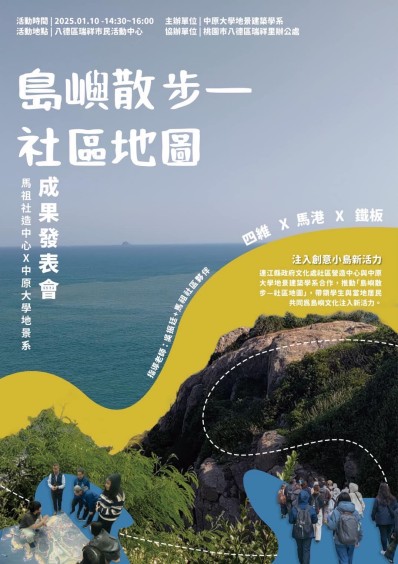
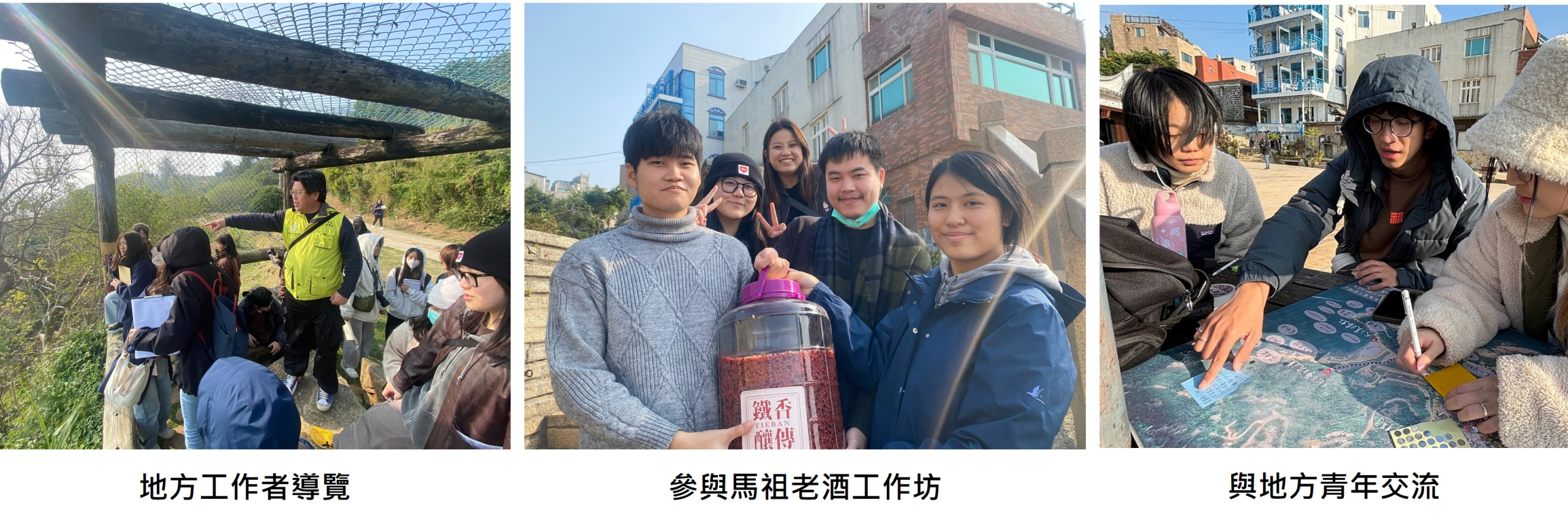
The course *Social Design and Regional Revitalization* was taught by Professor Wu Chen-Ting of the Department of Landscape Architecture. Centered on strengthening students’ interdisciplinary capabilities in environmental planning through the development of proposals for regional revitalization projects, the course brought students into the settlements of Tieban, Magang, and Sihwei in Nangan, Matsu. Through walking tours, interviews, collaborative mapping, and iterative revisions, the students developed the preliminary outcome of *Island Walks – Community Mapping*.
This teaching initiative was conducted in collaboration with the Community Development Center of the Department of Cultural Affairs, Lienchiang County Government, building upon a long-standing foundation of collaboration between local communities and Chung Yuan Christian University. During the short but intensive fieldwork period, students encountered the complexities of island-scale environments: the distances between settlements, transportation accessibility, the interplay between military landscapes and everyday life, and the tensions between tourism and local living.
Through the course, students were encouraged to understand that a place is not a static backdrop, but a living context shaped collectively by people, landscapes, stories, and the rhythms of everyday life.
Teaching Process and Methodology
The course was structured into four interconnected stages, progressing from theoretical understanding to field-based practice and, ultimately, the evaluation of outcomes. Through this process, students were guided to gradually develop the capacity to apply their landscape architecture expertise to local contexts and community-based initiatives.
Stage 1: Pre-Fieldwork Preparation
The first stage focused on establishing students’ foundational understanding of regional revitalization and social design. The instructor introduced current trends, practical challenges, and common misconceptions surrounding regional revitalization, followed by an introduction to the concept of social design.
Students then participated in a walking tour of a benchmark case in Longtan and heard from young people from Matsu, who shared their experiences in planning local tours and walking tours. These activities helped students develop a basic understanding of the Matsu context and provided important references for subsequent literature research and fieldwork preparation.
Stage 2: Action and Implementation
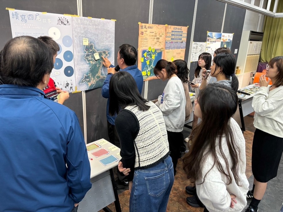
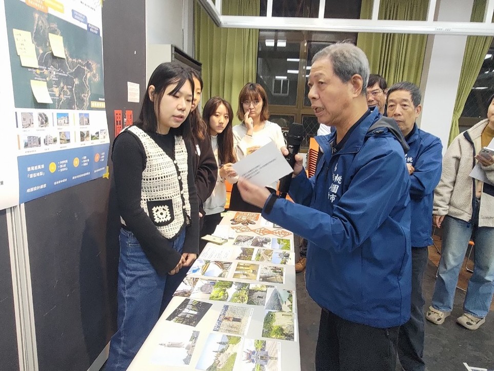
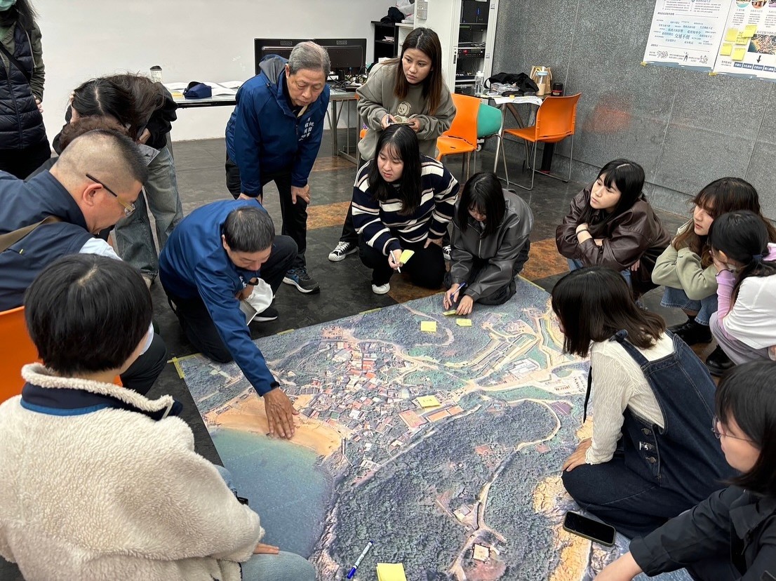
In the early stage of implementation, a participatory design workshop was first held on campus. Students set up exhibition stations using images, archival photographs, and interactive media, inviting Matsu residents living in Taiwan to participate in dialogue. Through these conversations, they collected firsthand interview data and identified places and spatial experiences that were meaningful to participants.
During the workshop, an elderly Matsu resident stood in front of a large map spread out by the students and pointed to one of the routes, saying, “That’s not how we used to walk it.” The students were momentarily unable to respond to the explanation they had prepared and instead paused to invite him to share his memories in his own words. Shortly afterward, another resident joined the conversation and offered a different recollection of the same route. At that moment, the students began to realize that a place is not an object to be verified, but a continuously evolving context filled with diverse and sometimes conflicting perspectives. The role of the map also shifted—from a tool for explanation to a medium for facilitating dialogue.
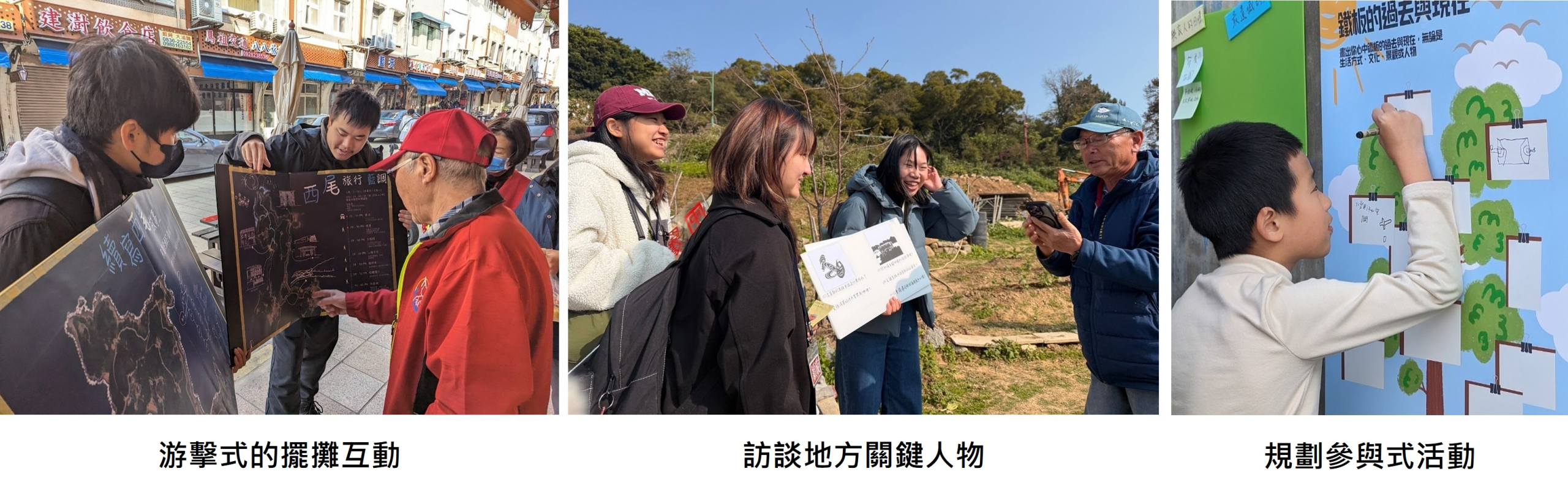
The students then traveled to Matsu for fieldwork, where they reviewed existing wayfinding systems and tour plans and developed preliminary interactive maps incorporating local knowledge. Rather than simply presenting routes, these maps explored ways of organizing everyday landscapes and spatial relationships through contextual illustrations and sectional representations—from the sea to the streets and from the mountains to the settlements.
During the fieldwork, students informally presented unfinished map prototypes to local residents, gathering immediate feedback and gaining a deeper understanding of local expectations and concerns regarding how the maps should represent the area. After returning to campus, each group organized its field data and engaged in further discussion and refinement, reconsidering how the maps could move beyond simply organizing information to become carriers of local memories and lived experiences.
Stage 3: Design and Development
Building on the preceding analysis and collaborative work, students developed six community map prototypes, each focusing on themes such as industrial and cultural heritage, everyday landscapes, traditional settlement regeneration, ecological sustainability, and youth returning to their hometowns.
Each group completed a participatory pop-up exhibition, a short video, a community map, and interactive objects, followed by a series of interim project presentations. Young people from Matsu with practical experience in map-making were invited to review the projects. Through repeated testing and refinement, students came to understand that design must be continuously adjusted between conceptual ideas and real-world contexts of use.
Stage 4: Evaluation, Reflection, and Final Presentation
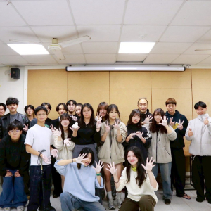
Given the distance to the field site, the final presentation was held in Bade with the support of Matsu residents living in Taiwan. Each group presented its work through a combination of static exhibitions and dynamic, interactive displays. Feedback from local residents, together with observations from the instructors, was used to evaluate the students’ abilities to integrate information and communicate their ideas.
At the presentation, after listening to a student explain the project, one resident simply said, “I can understand this map.”
For the students, those few words were more concrete than any formal evaluation. They signified that the design had moved beyond professional boundaries and truly entered into the users’ understanding of everyday life.
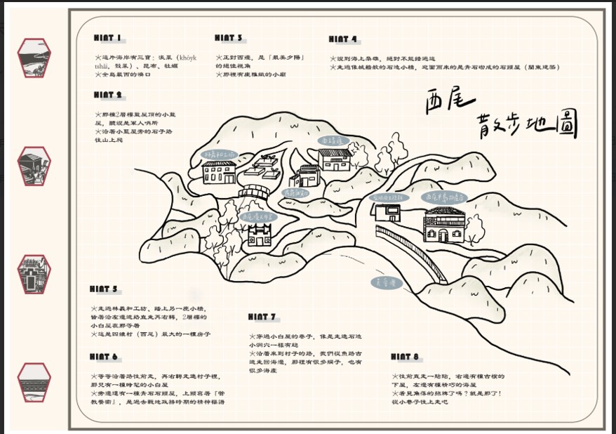
Student Outcomes – Western Peninsula Walking Map of Matsu
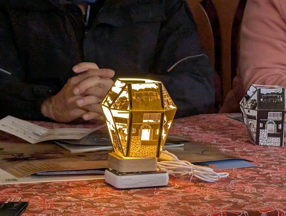
Student Outcomes – Lightboxes Showcasing Local Character
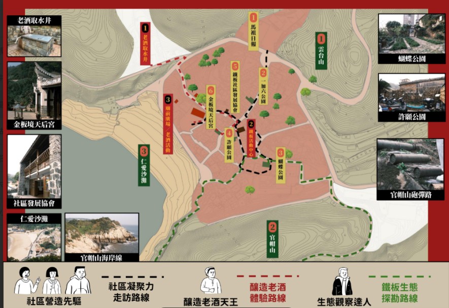
Student Outcomes – Island Walks Map
第四階段為檢驗診斷與成果發表。
考量場域距離,期末成果改於在台馬祖居民協助下於八德辦理發表。各組以靜態展覽與動態互動並行的方式呈現成果,透過居民回饋與教師觀察,檢驗學生的整合與溝通能力。在成果發表現場,有居民在聽完學生的說明後,只簡單說了一句:「這張地圖,我看得懂。」對學生而言,這句話比任何評語都來得具體。它意味著,設計不只是被展示,而是真的跨過專業的邊界,進入了使用者的生活理解之中。
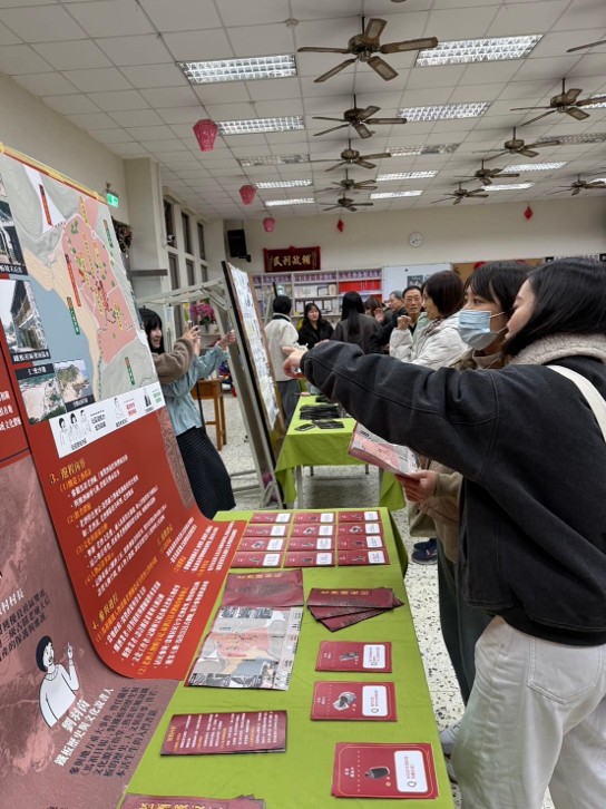
Design Integration: Project Presentation in Bade, Taoyuan
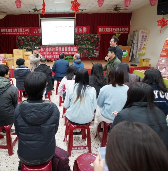
Design Integration: Final Presentation in Bade, Taoyuan
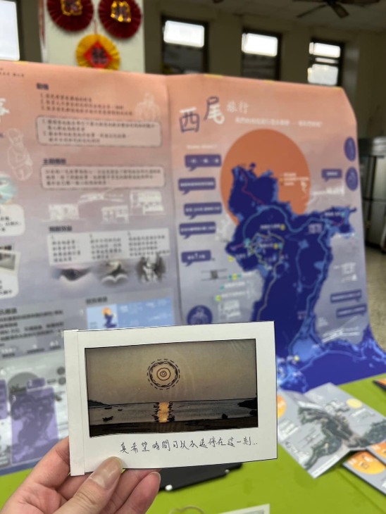
Student Outcomes – Check-In Postcards
Student Learning Outcomes and Growth
Three significant changes can be identified from students’ learning reflections and observations throughout the course.
First, students’ understanding of regional revitalization evolved from an abstract concept into a concrete experience. They gradually came to recognize that regional revitalization involves everyday choices, memories, and relationships, rather than simply being about physical or spatial transformation.
Second, students developed a new understanding of the role of landscape architecture. They came to realize that design is not merely about arranging spaces, but also about engaging with the stories, memories, and community relationships embedded within those spaces.
Third, students learned to take action amid uncertainty, recognizing that design is an iterative and continuously evolving process that requires repeated testing, reflection, and refinement.
Concluding Remarks
An island is not a place that can be understood simply by walking through it once.
Nor is a map considered complete simply because it has been drawn.
What truly matters is the willingness to pause within a place—to listen, to organize, to create together, and to gradually transform its stories into forms that can be shared and used by the community.
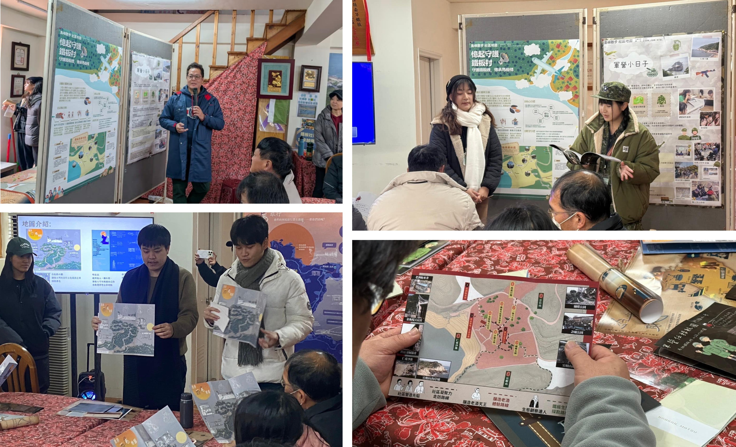
Matsu Project Presentation